Friday, February 29, 2008

Longitudinal View


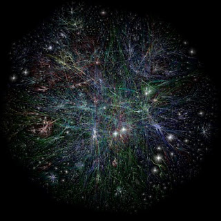
A representation of the internet by longitude, from the Cooperative Association for Internet Data Analysis.

From CAIDA's site:

This visualization represents a macroscopic snapshot of the Internet for two weeks: August 1st, 2007 through August 15th, 2007. The graph reflects 760,922 IP addresses and 1,400,796 IP links ... We aggregate this view of the network into a topology of Autonomous Systems (ASes), each of which approximately maps to an Internet Service Provider (ISP). We map each IP address to the AS responsible for routing it, i.e., the origin (end-of-path) AS for the best match IP prefix of this address observed in Border Gateway Protocol (BGP) routing tables. Eighty percent of ASes with known locations are placed in the Americas, Europe/Africa, and Asia/Oceana.

via millsworks

Saturday, February 16, 2008

Country domain mapping


Zooknic.com maps the relative distribution of domains in Google Earth using the concepts of political and technical location.

Wednesday, February 13, 2008

Undersea Internet


This map from the Guardian UK shows the undersea cable network supporting much of the world's internet access. (source: braincubes.be)

Saturday, January 26, 2008

Internet bandwidth map


This is old news, but TeleGeography published an updated Global Internet Map in 2006 showing "international internet bandwidth, scaled by capacity—covering backbones operated by more than 300 international Internet carriers as of mid-2005" ... in any case, it's $225 so I probably won't buy it to see the detail, but in the interest of compiling a more comprehensive collection of what is available, I am posting on it. The 2001 version looked good too.

Saturday, January 5, 2008

Opte Project


One of the original widely viewed representations of the internet from the Opte Project (2003 I think). Captures the organic fractal-like development of the web.

Wednesday, November 28, 2007

Language on the Internet


This great article/project is home to a number of maps and animations all along the idea of an "internet archipelago." This one in particular looks at the internet through language:

"this mapping is limited to countries are home to a significant population speaking an internet language (a significant population is defined as at least 100,000 first tongue speakers). the political map of the world is rearranged based on internet language populations to create the language archipelago. the united states is placed at the center of the language archipelago for several reasons. it is the only country that has a significant population speaking all ten internet languages. it has the most extensive internet infrastructure. and it was the birthplace of the internet. from there, all the other internet countries are arranged in rays corresponding to the countries’ dominant internet language based on their ascendancy. the national flag at the end of each ray is used as a visual legend to key the ray’s language. this map illustrates the dominant role of the world’s superpowers on in internet and reveal the circumstance of countries at the periphery."

Geography of Domain Names


According to this article on Mappa Mundi there are currently over 18 million .com domains registered on the Internet, along with another 11 million domains of varying sorts. This map was compiled using the billing addresses of domains registered in Manhattan.